Geologic Map of the Wind River Mountains
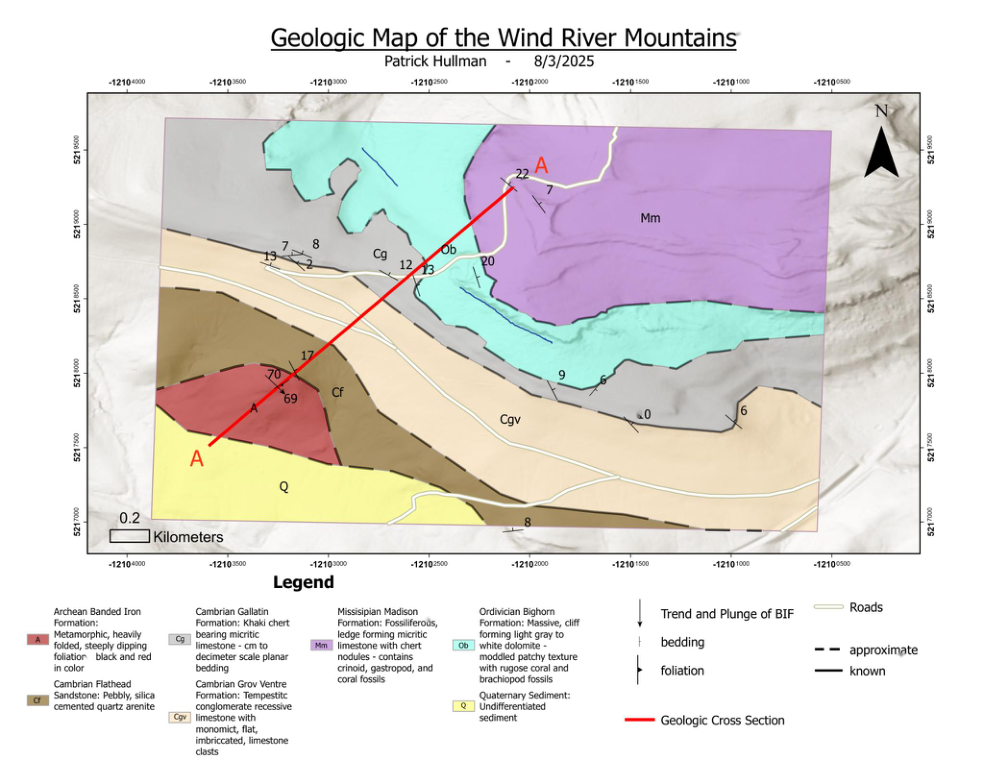
Geologic mapping across the Wind River Range highlighting Archean BIF, Paleozoic carbonates, Quaternary sediments, and structural measurements; includes a cross section A–A′.
GIS & geospatial analysis — cartography, spatial data engineering, terrain analytics.
Geologic mapping across the Wind River Range highlighting Archean BIF, Paleozoic carbonates, Quaternary sediments, and structural measurements; includes a cross section A–A′.
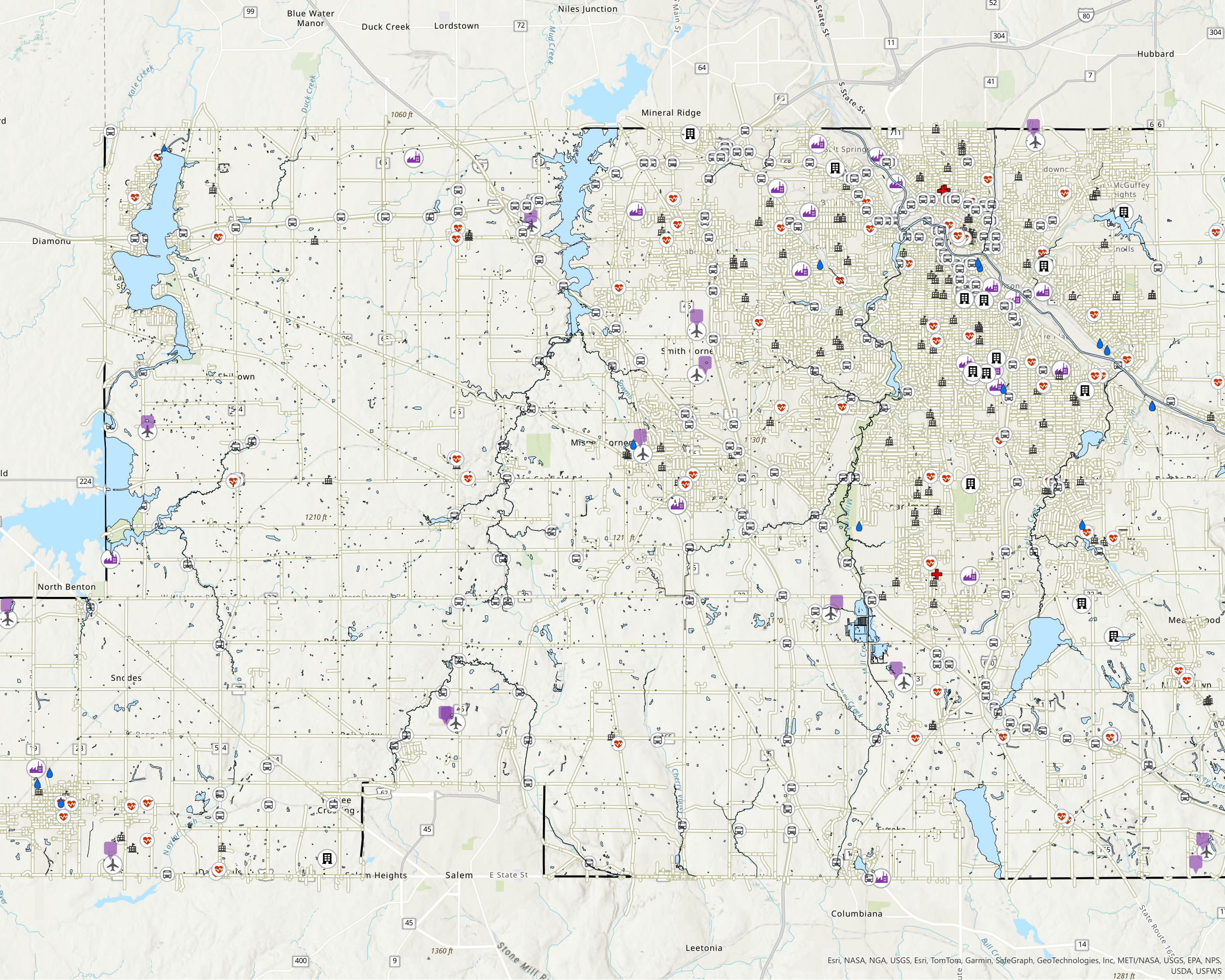
Publication-style layout with neighborhoods, hydrology, elevation markers, and major routes.
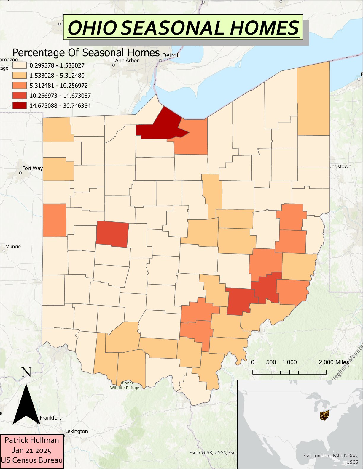
Percentage of seasonal homes across Ohio counties using ACS data and balanced classes.
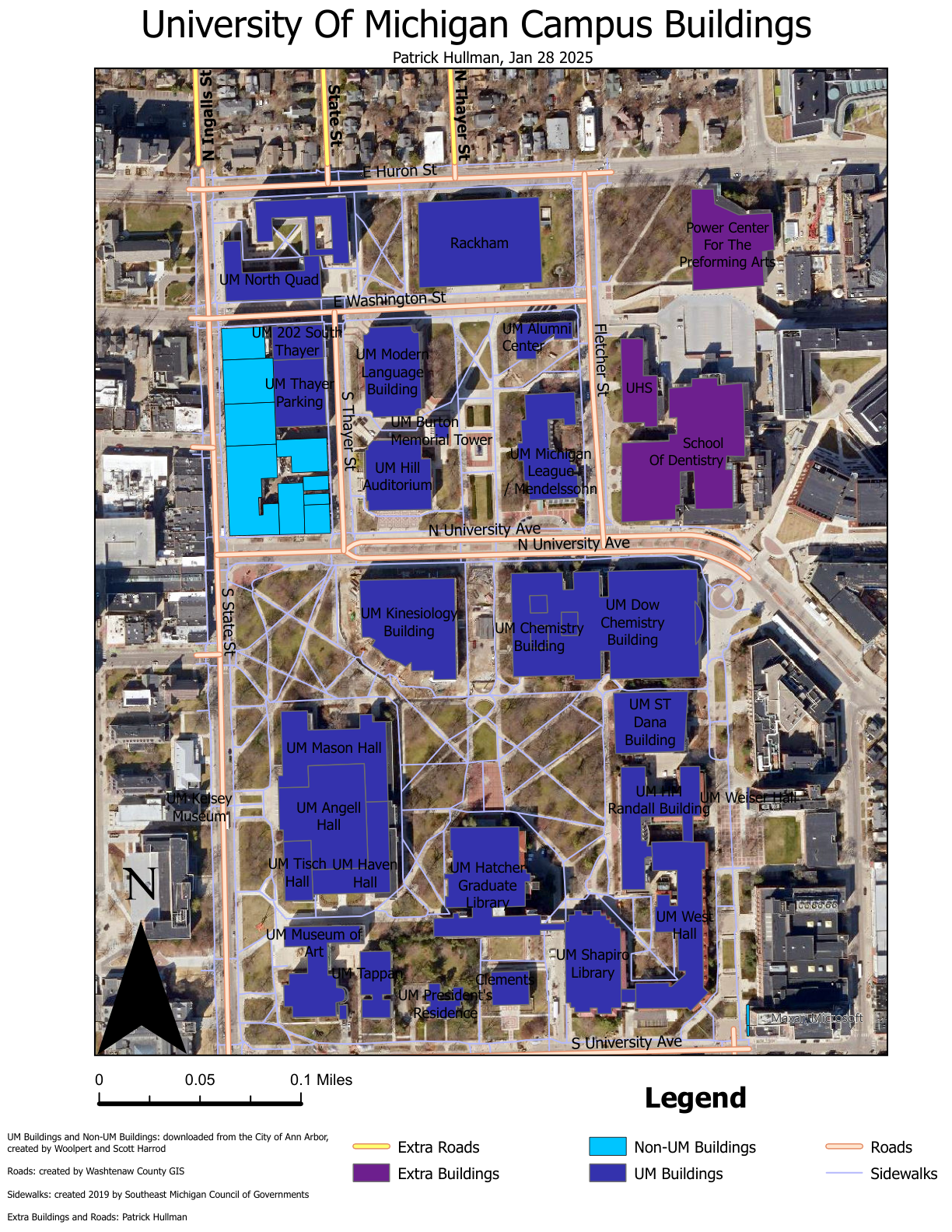
Unified map of UM and non‑UM buildings with roads and sidewalks across local/regional datasets.
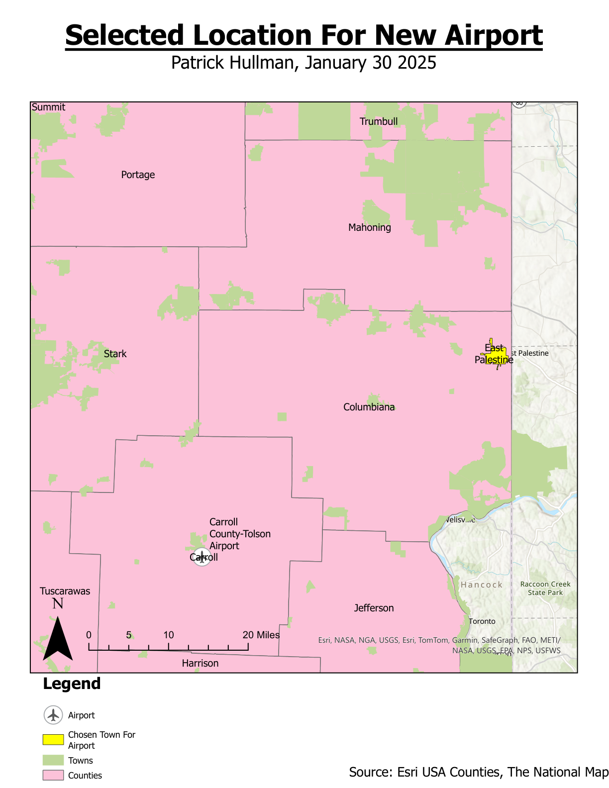
Candidate airport siting with county context, towns, and access considerations for a short‑list location.
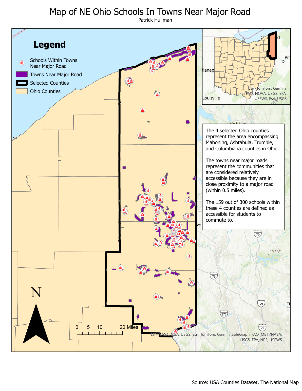
Towns within 0.5 miles of major roads and proportion of schools within these accessible areas.
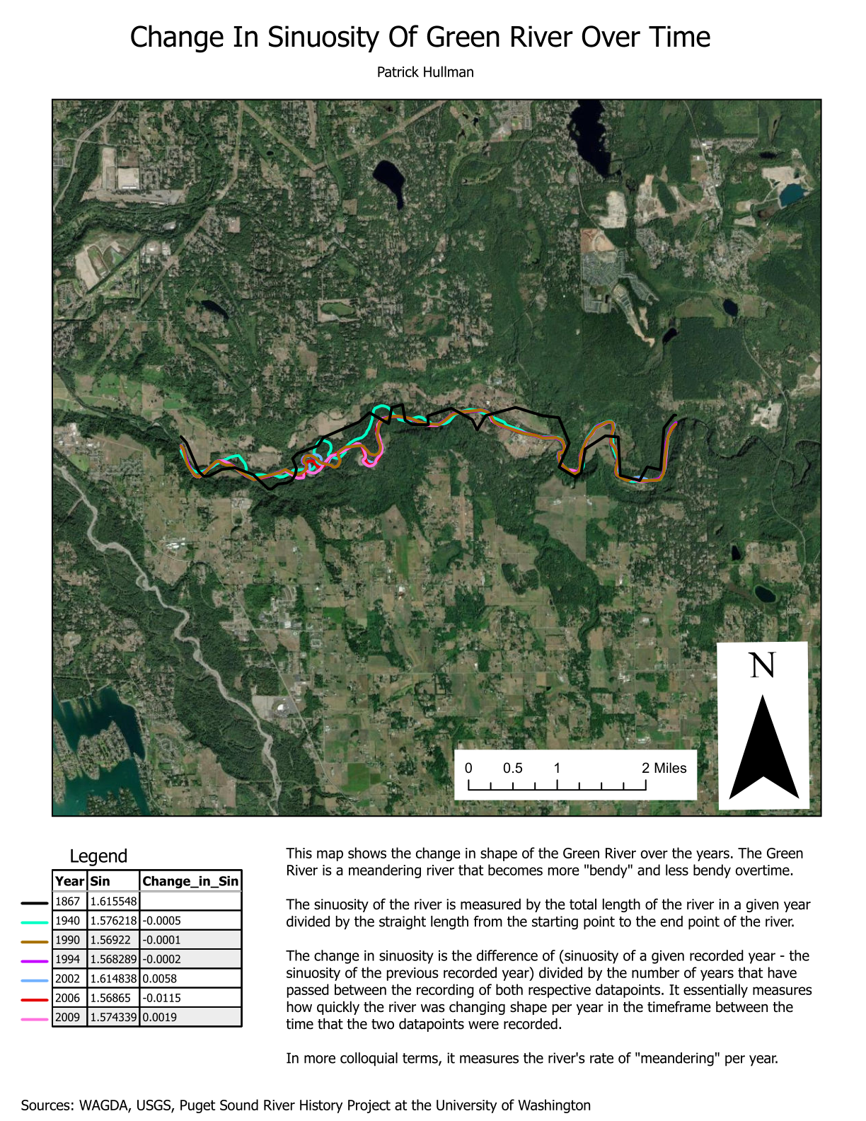
Time‑series of meander evolution with computed sinuosity and per‑year change.
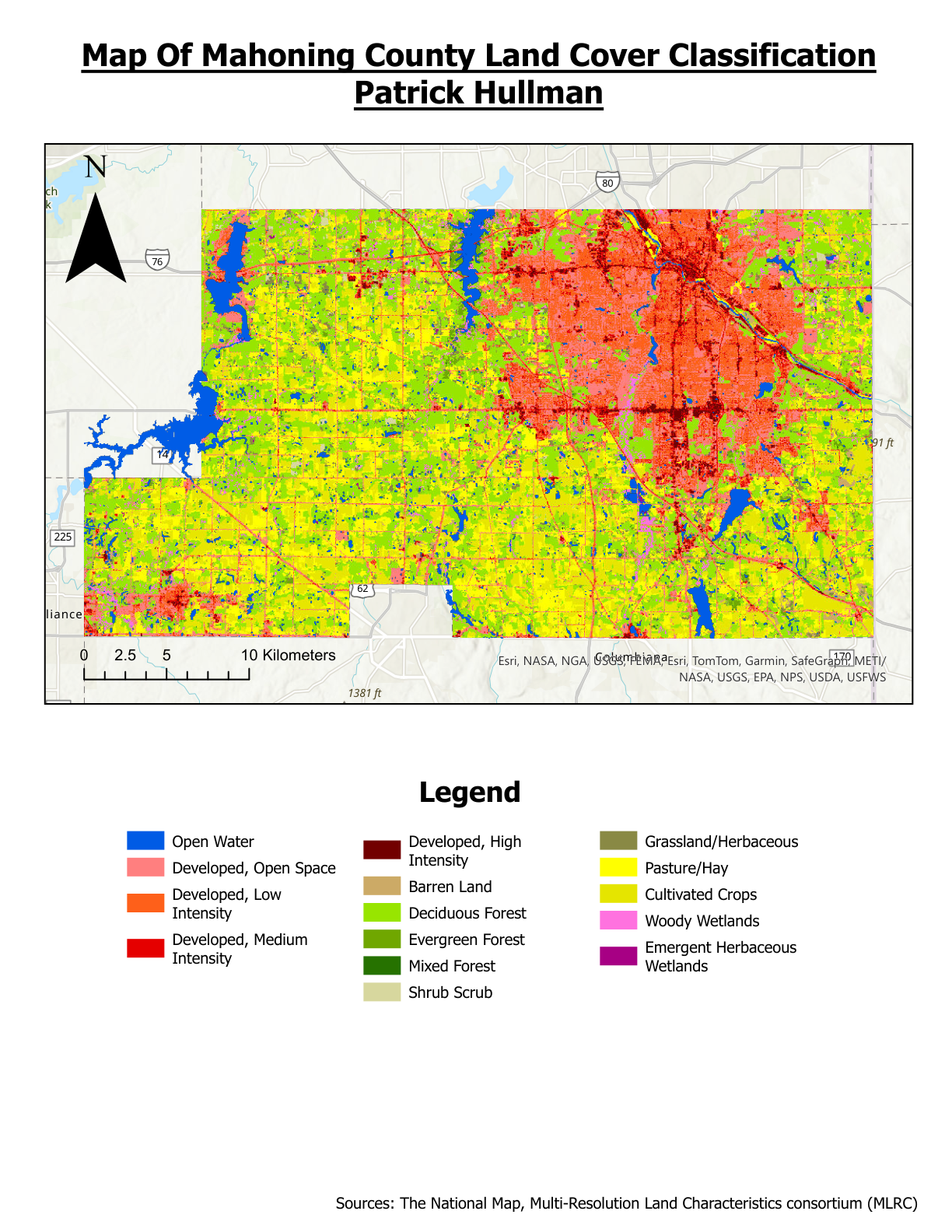
County‑wide land cover classification with developed intensities, agriculture, and wetlands classes.
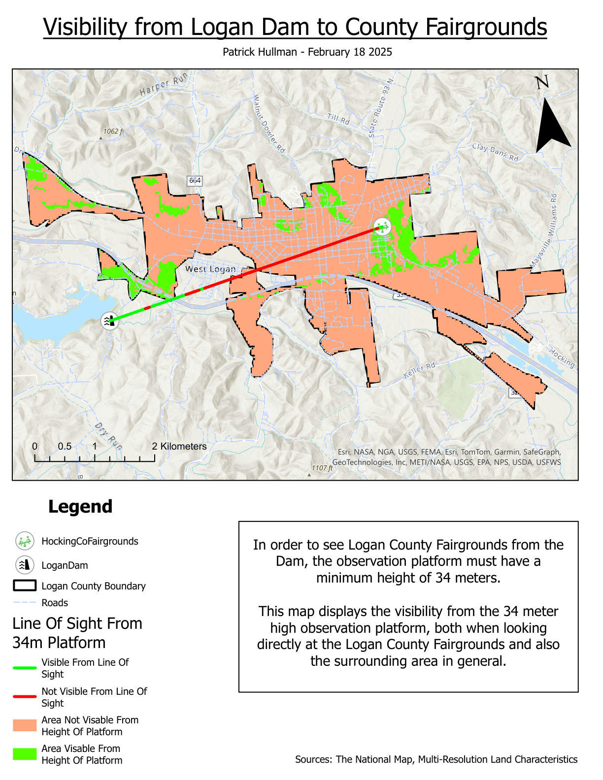
Visibility analysis showing minimum platform height and visible areas based on terrain and land cover.
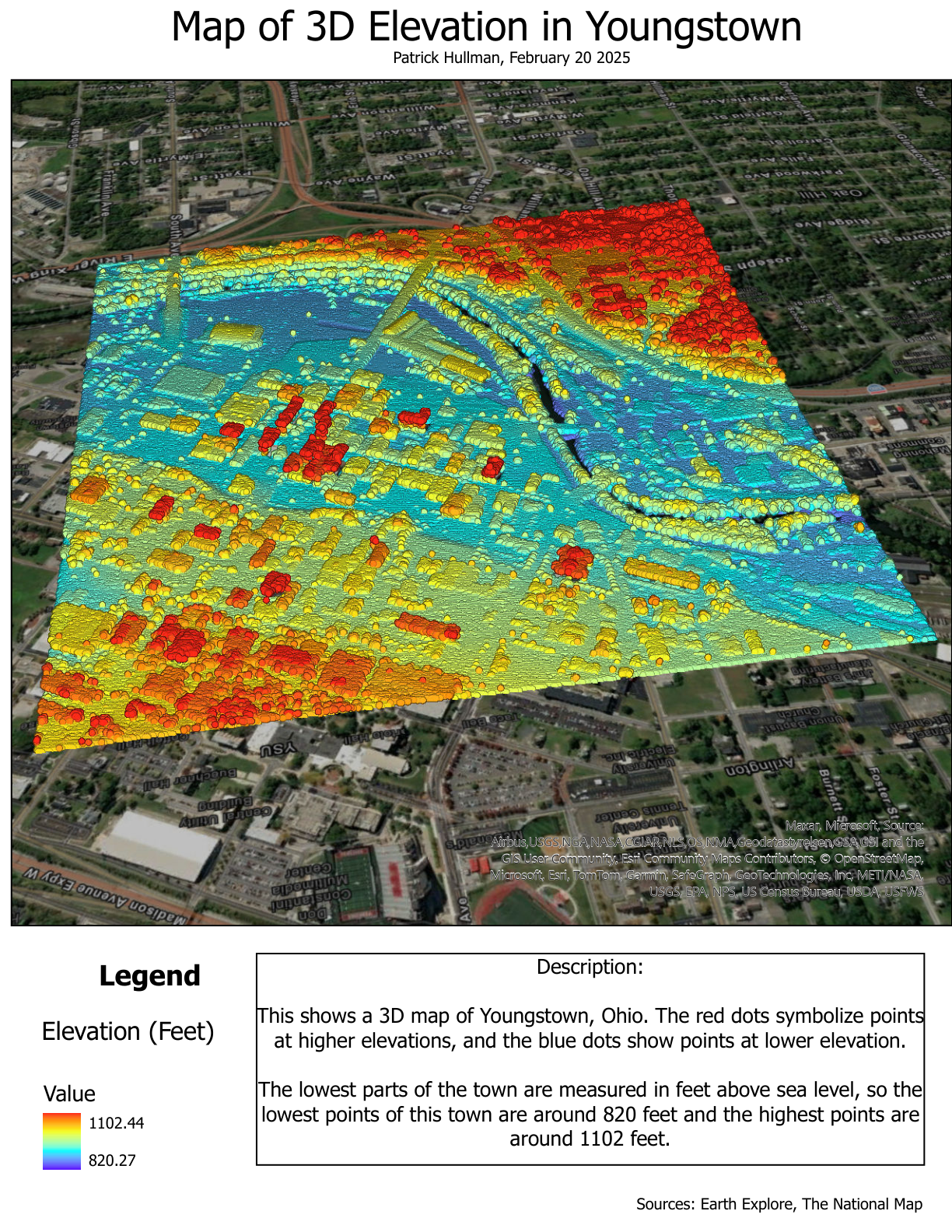
3D elevation rendering with color‑mapped heights from ~820 ft to ~1102 ft.
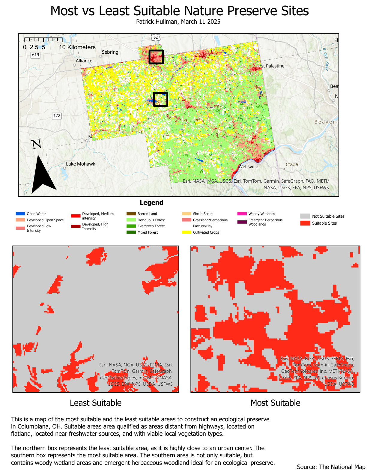
Suitability model using distance from highways, slope, freshwater proximity, and vegetation.
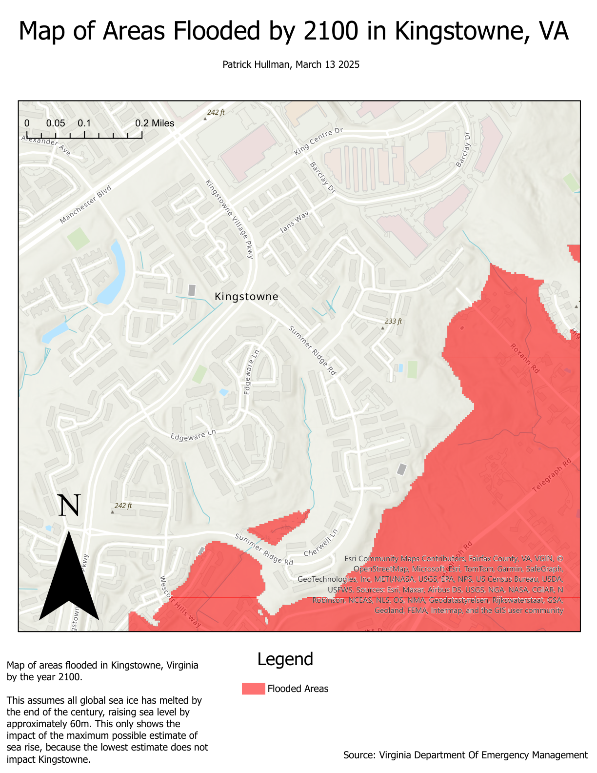
Two-scale look at flooding impacts: local effects in Kingstowne, VA, and global inundation patterns.
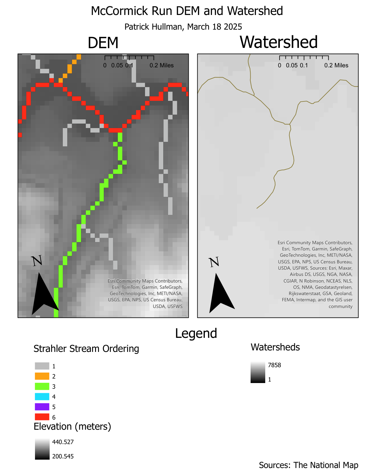
Watershed delineation and stream network analysis from DEM with Strahler stream ordering.
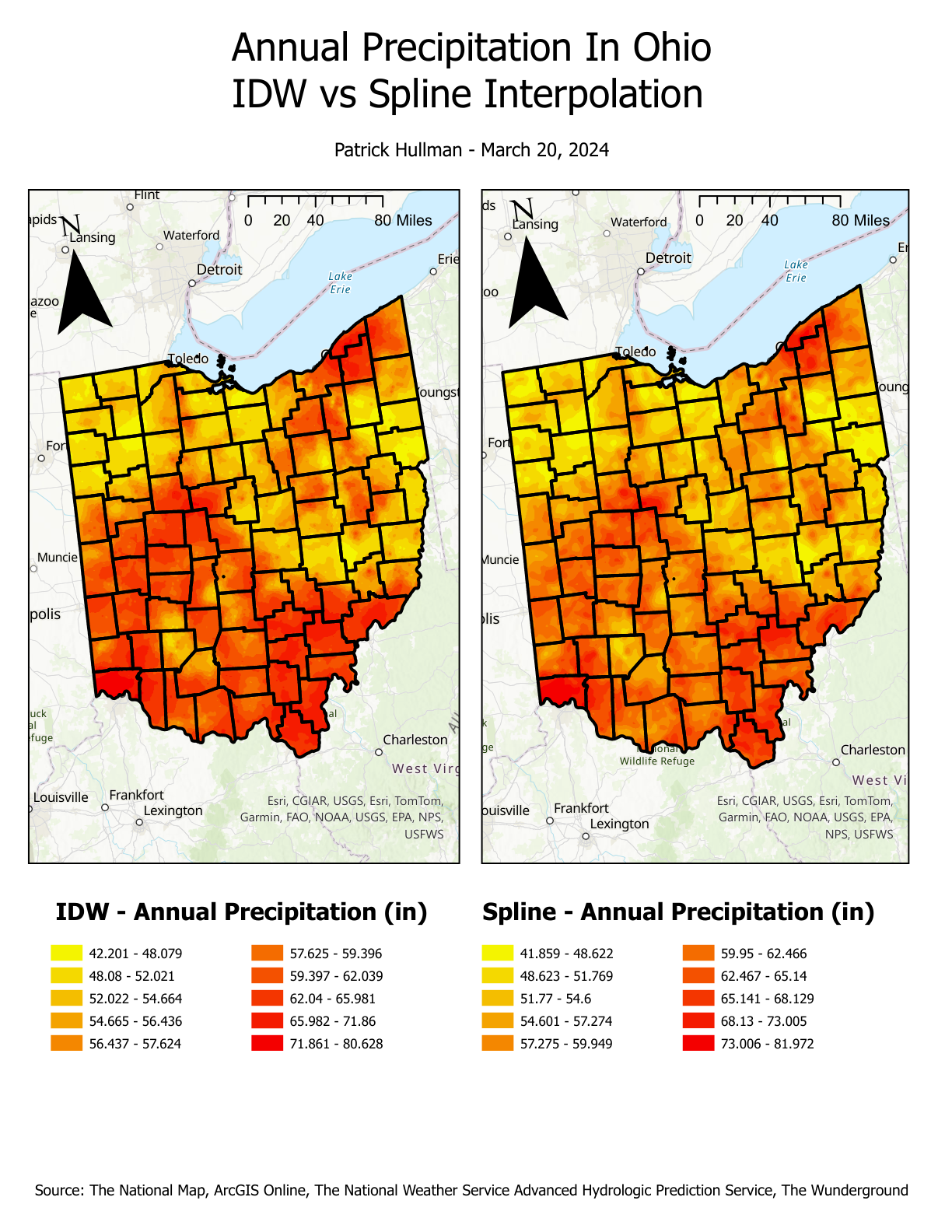
Comparison of two interpolation methods on statewide precipitation observations.
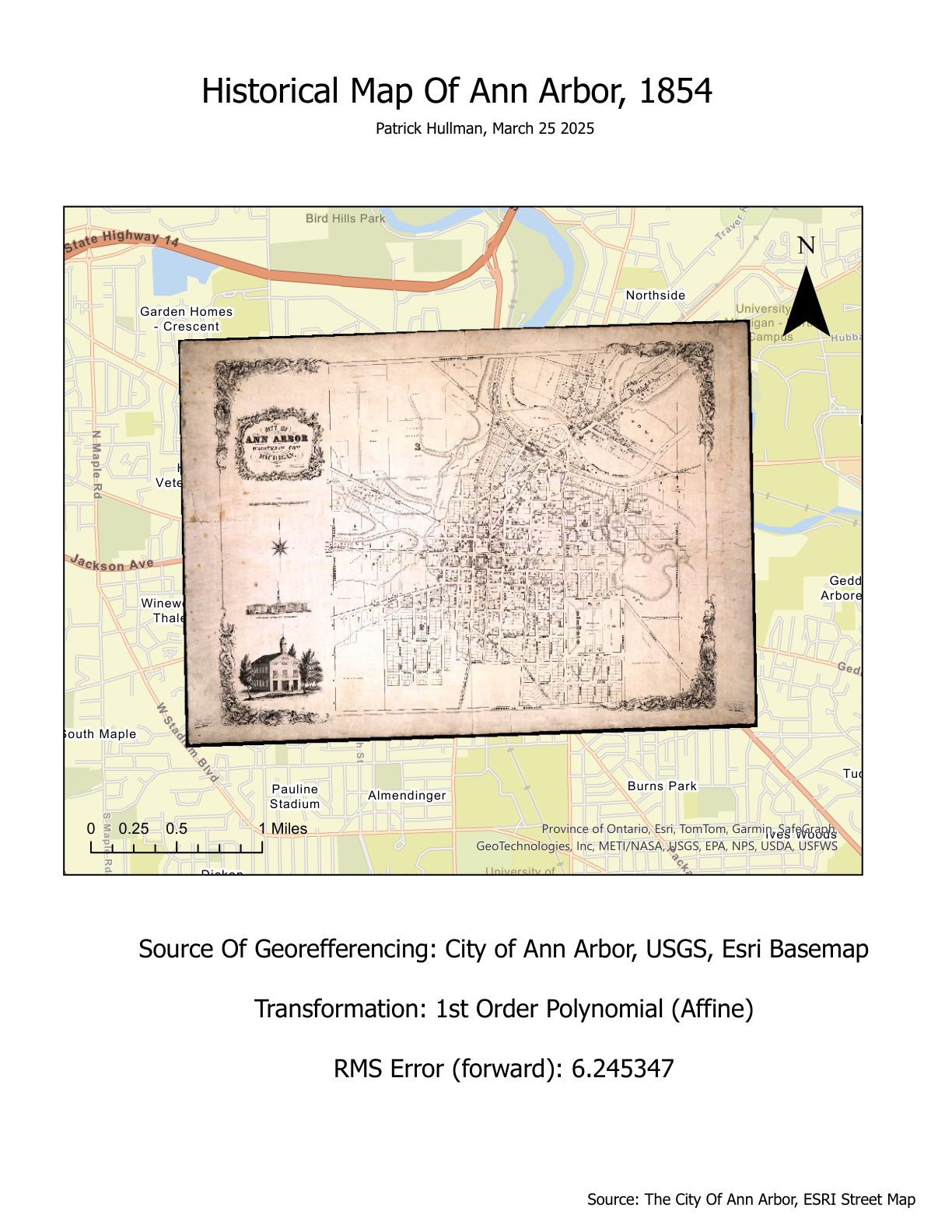
Historical maps and a modern urban footprint to visualize the city’s expansion over time.
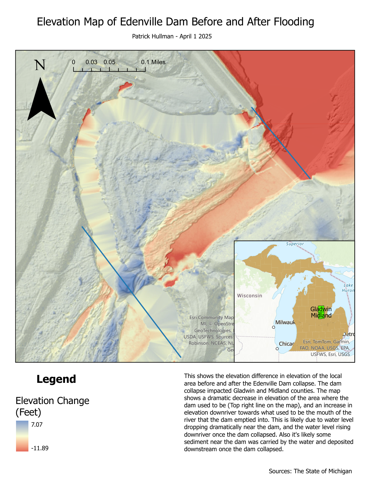
Elevation differences illustrating geomorphic change from the Edenville Dam collapse.
I'm a Archeologist and Geologist with a focus in Oceanography. I have a strong GIS background using machine learning and a variety of GIS techniques for research applications in paleoseismology, land cover use, reconstructive historical maps, ancient migration patterns of native peoples, and predictive hydrologic models.